


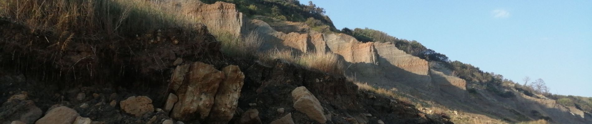
villers les vaches noires, le Montcel

serge.guerroult
User

Length
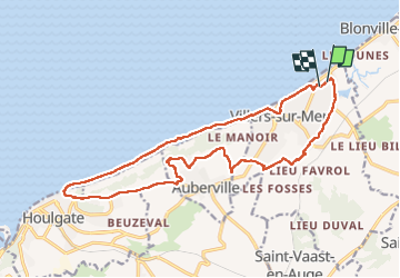
17.5 km

Max alt
126 m

Uphill gradient
221 m
Km-Effort
20 km

Min alt
0 m

Downhill gradient
222 m
Boucle
Yes
Creation date :
2022-08-31 06:47:26.162
Updated on :
2022-09-04 10:33:32.01
3h07
Difficulty : Very difficult

FREE GPS app for hiking
 SityTrail
IGN / Geographical institutes
SityTrail Plus
The world is yours!
About
Trail Walking of 17.5 km to be discovered at Normandy, Calvados, Villers-sur-Mer. This trail is proposed by serge.guerroult.
Photos


Positioning
Country:
France
Region :
Normandy
Department/Province :
Calvados
Municipality :
Villers-sur-Mer
Location:
Unknown
Start:(Dec)
Start:(UTM)
282749 ; 5468241 (31U) N.
Comments