


La roche pourrie

arno55v
User

Length
6.3 km

Max alt
2006 m

Uphill gradient
567 m
Km-Effort
13.9 km

Min alt
1568 m

Downhill gradient
575 m
Boucle
Yes
Creation date :
2014-12-10 00:00:00.0
Updated on :
2014-12-10 00:00:00.0
2h49
Difficulty : Easy

FREE GPS app for hiking
 SityTrail
IGN / Geographical institutes
SityTrail Plus
The world is yours!
About
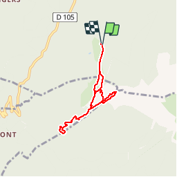
Trail Walking of 6.3 km to be discovered at Auvergne-Rhône-Alpes, Savoy, Queige. This trail is proposed by arno55v.
Positioning
Country:
France
Region :
Auvergne-Rhône-Alpes
Department/Province :
Savoy
Municipality :
Queige
Location:
Unknown
Start:(Dec)
Start:(UTM)
301979 ; 5062997 (32T) N.
Comments