


de Migennes à Briare - de Migennes à Briare

norihtom
User
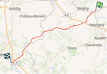

Length
81 km

Max alt
246 m

Uphill gradient
772 m
Km-Effort
91 km

Min alt
76 m

Downhill gradient
720 m
Boucle
No
Creation date :
2022-08-31 20:27:31.345
Updated on :
2022-08-31 20:27:31.345

FREE GPS app for hiking
 SityTrail
IGN / Geographical institutes
SityTrail Plus
The world is yours!
About
Trail of 81 km to be discovered at Bourgogne-Franche-Comté, Yonne, Migennes. This trail is proposed by norihtom.
Description
de Migennes à Briare
Positioning
Country:
France
Region :
Bourgogne-Franche-Comté
Department/Province :
Yonne
Municipality :
Migennes
Location:
Unknown
Start:(Dec)
Start:(UTM)
538313 ; 5312246 (31T) N.
Comments