Trail Walking Maasmechelen - Mechelse Heide  - Photo
© OpenStreetMap contributors
Length
Length
14.2 km
Max alt
Max alt
101 m
Uphill gradient
Uphill gradient
156 m
Km-Effort
Km-Effort  
16.2 km
Min alt
Min alt
46 m
Downhill gradient
Downhill gradient
156 m
Boucle
Boucle
Yes
Creation date :
2022-09-01 12:02:37.993
Updated on :
2022-09-14 14:40:49.063

(2 Reviews)

Walking
Walking
3h41
Difficulty : Easy

Scan this QR Code to open this trail in the SityTrail application

FREE GPS app for hiking

Logo SityTrail SityTrail

IGN / Geographical institutes

Download SityTrail from the App Store Download SityTrail from Google Play

Logo SityTrail SityTrail World

The world is yours!

Download SityTrail from the App Store Download SityTrail from Google Play Download SityTrail on Huawei AppGallery

About

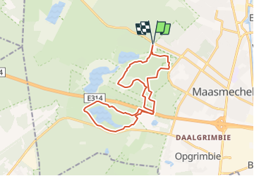
Trail Walking of 14.2 km to be discovered at Flanders, Limburg, Maasmechelen. This trail is proposed by mumu.larandonneuse.

Description

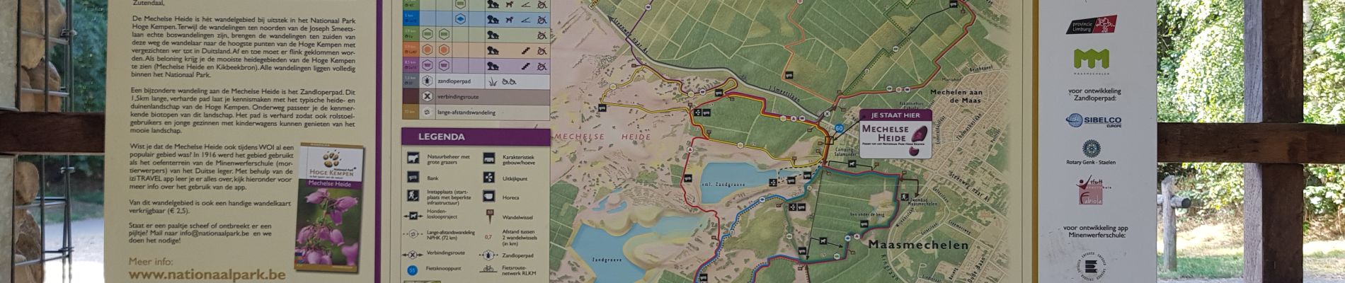
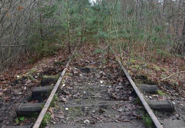
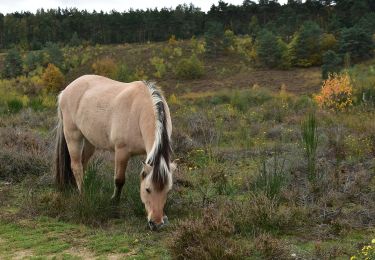
L'itinéraire traverse le Parc National de la Haute Campine (Hoge Kempen). Nous marchons dans le Mechelse Heide et dans la vallée du Kikbeekbron.  

➕ La bruyère pourpre fleurit en août-septembre. 
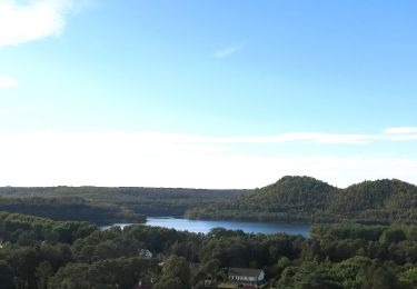
➕ De magnifiques vues.
📍& 🅿️ Porte d'entrée du parc : à Maasmechelen, Joseph Smeetslaan 280.
www.wandelgidszuidlimburg.com n°250 (modifié)

Elevation profile

Photos

Positioning

Country:
Belgium
Region :
Flanders
Department/Province :
Limburg
Municipality :
Maasmechelen
Location:
Mechelen-aan-de-Maas
Start:(UTM)
686678 ; 5650748 (31U) N.

Comments

Please log in to post a review or rate the element


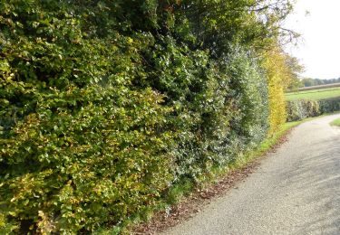
Superbe parcours 100 % nature.


Trails nearby

Trail On foot As - Mechelse Heide Noord - Photo
On foot
PRO

On foot

Easy
As, Flanders, Limburg, Belgium
4.3 km | 4.8 km-effort
1h 5min
No
Trail On foot Maasmechelen - Erfgoedwandeling Eisden Tuinwijk - Photo
On foot
PRO

On foot

Easy
Maasmechelen, Flanders, Limburg, Belgium
3.1 km | 3.3 km-effort
44min
Yes
Trail On foot Dilsen-Stokkem - Connecterra Rode driehoek - Photo
On foot
PRO

On foot

Easy
Dilsen-Stokkem, Flanders, Limburg, Belgium
6.2 km | 7 km-effort
1h 35min
No
Trail On foot Maasmechelen - Station As Groene rechthoek - Photo
On foot
PRO

On foot

Easy
Maasmechelen, Flanders, Limburg, Belgium
3.3 km | 3.8 km-effort
51min
Yes
Trail On foot Maasmechelen - Leut & Meeswijk Gele zeshoek - Photo
On foot
PRO

On foot

Easy
Maasmechelen, Flanders, Limburg, Belgium
7 km | 7.4 km-effort
1h 40min
Yes
Trail On foot Maasmechelen - Station As Blauwe ruit - Photo
On foot
PRO

On foot

Easy
Maasmechelen, Flanders, Limburg, Belgium
6.5 km | 7.1 km-effort
1h 36min
Yes
Trail On foot Maasmechelen - Station As Rode driehoek - Photo
On foot
PRO

On foot

Easy
Maasmechelen, Flanders, Limburg, Belgium
12 km | 13.4 km-effort
3h 3min
Yes
Trail On foot Dilsen-Stokkem - Litzberg groene rechthoek - Photo
On foot
PRO

On foot

Easy
Dilsen-Stokkem, Flanders, Limburg, Belgium
3 km | 3.7 km-effort
49min
Yes
Trail On foot Maasmechelen - Kikbeekbron Blauwe ruit - Photo
On foot
PRO

On foot

Easy
Maasmechelen, Flanders, Limburg, Belgium
4.6 km | 5.2 km-effort
1h 11min
Yes


Close
My subscriptions