Trail Walking Saint-Pierre-du-Vauvray - 20220901-St Pierre du Vauvray - Photo

20220901-St Pierre du Vauvray

 doudet
doudet

User

© OpenStreetMap contributors
Length
Length
21 km
Max alt
Max alt
144 m
Uphill gradient
Uphill gradient
326 m
Km-Effort
Km-Effort  
25 km
Min alt
Min alt
6 m
Downhill gradient
Downhill gradient
326 m
Boucle
Boucle
Yes
Creation date :
2022-09-01 07:09:55.047
Updated on :
2022-09-02 06:21:54.494

(0 Reviews)

Walking
Walking
5h27
Difficulty : Medium

Scan this QR Code to open this trail in the SityTrail application

FREE GPS app for hiking

Logo SityTrail SityTrail

IGN / Geographical institutes

Download SityTrail from the App Store Download SityTrail from Google Play

Logo SityTrail SityTrail Plus

The world is yours!

Download SityTrail from the App Store Download SityTrail from Google Play Download SityTrail on Huawei AppGallery

About

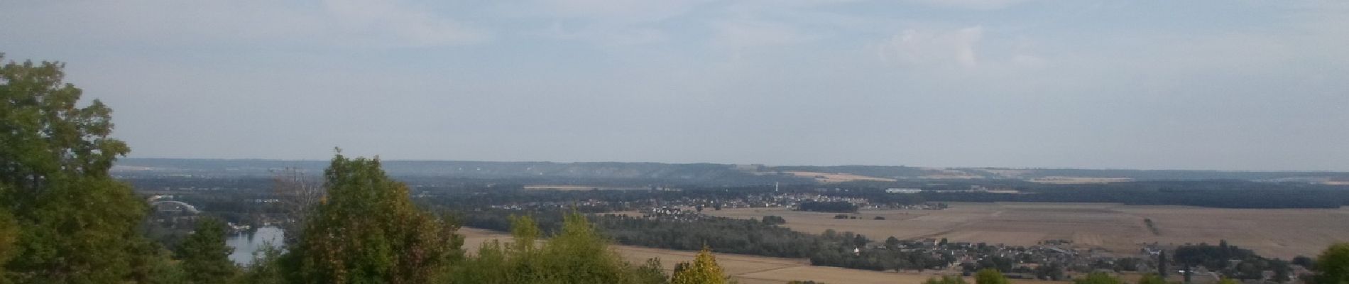
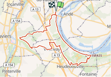
Trail Walking of 21 km to be discovered at Normandy, Eure, Saint-Pierre-du-Vauvray. This trail is proposed by doudet.

Description

Boucle A-R au départ de la Gare de St Pierre du Vauvray

Attention le pont de Hedeubouville est fermé pour cause travaux
Passer par la passerelle du relais routier

Elevation profile

Photos

56 photos in total. Please click on a photo to see them all in the gallery.

Positioning

Country:
France
Region :
Normandy
Department/Province :
Eure
Municipality :
Saint-Pierre-du-Vauvray
Location:
Unknown
Start:(UTM)
370777 ; 5454953 (31U) N.


Close
My subscriptions