


66--Belloc : Les deux Chapelles-21/08/2014-

Jovila
User

Length
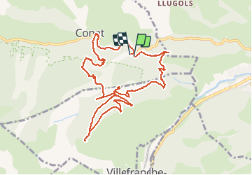
12.7 km

Max alt
1060 m

Uphill gradient
630 m
Km-Effort
21 km

Min alt
502 m

Downhill gradient
621 m
Boucle
Yes
Creation date :
2015-11-16 00:00:00.0
Updated on :
2015-11-16 00:00:00.0
4h25
Difficulty : Medium

FREE GPS app for hiking
 SityTrail
IGN / Geographical institutes
SityTrail Plus
The world is yours!
About
Trail Walking of 12.7 km to be discovered at Occitania, Pyrénées-Orientales, Conat. This trail is proposed by Jovila.
Description
Départ : Ria direction Conat après la borne km 4 repérer la piste à gauche (2 boites aux lettres sur des briques et poubelles)ce n'est pas un chemin privé. S'engager sur ce chemin et se garer.


Positioning
Country:
France
Region :
Occitania
Department/Province :
Pyrénées-Orientales
Municipality :
Conat
Location:
Unknown
Start:(Dec)
Start:(UTM)
448062 ; 4717640 (31T) N.
Comments