


SityTrail - Le Sioulot

jeanic63
User


3h00
Difficulty : Easy

FREE GPS app for hiking
 SityTrail
IGN / Geographical institutes
SityTrail Plus
The world is yours!
About
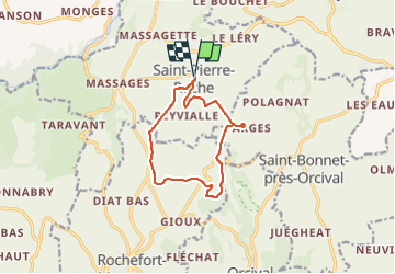
Trail On foot of 10.8 km to be discovered at Auvergne-Rhône-Alpes, Puy-de-Dôme, Saint-Pierre-Roche. This trail is proposed by jeanic63.
Description
Itinéraire au nord des monts Dore, près de Rochefort Montagne. Balade numérisée sur le terrain par Jean louis Phillipart. Retrouvez cette randonnée dans le topo Guide Chamina Massif du Sancy.
Positioning
Comments