


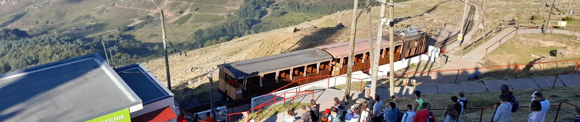
monté de la rhune et descente

bellouelo46
User
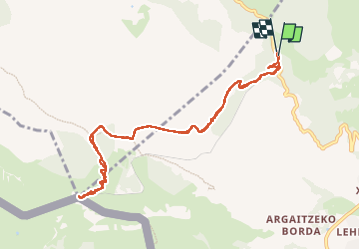

Length
10.9 km

Max alt
899 m

Uphill gradient
786 m
Km-Effort
21 km

Min alt
159 m

Downhill gradient
784 m
Boucle
Yes
Creation date :
2022-08-19 15:05:52.659
Updated on :
2022-09-11 10:49:07.98
2h58
Difficulty : Medium

FREE GPS app for hiking
 SityTrail
IGN / Geographical institutes
SityTrail Plus
The world is yours!
About
Trail Walking of 10.9 km to be discovered at New Aquitaine, Pyrénées-Atlantiques, Sare. This trail is proposed by bellouelo46.
Photos


Positioning
Country:
France
Region :
New Aquitaine
Department/Province :
Pyrénées-Atlantiques
Municipality :
Sare
Location:
Unknown
Start:(Dec)
Start:(UTM)
613412 ; 4798049 (30T) N.
Comments