


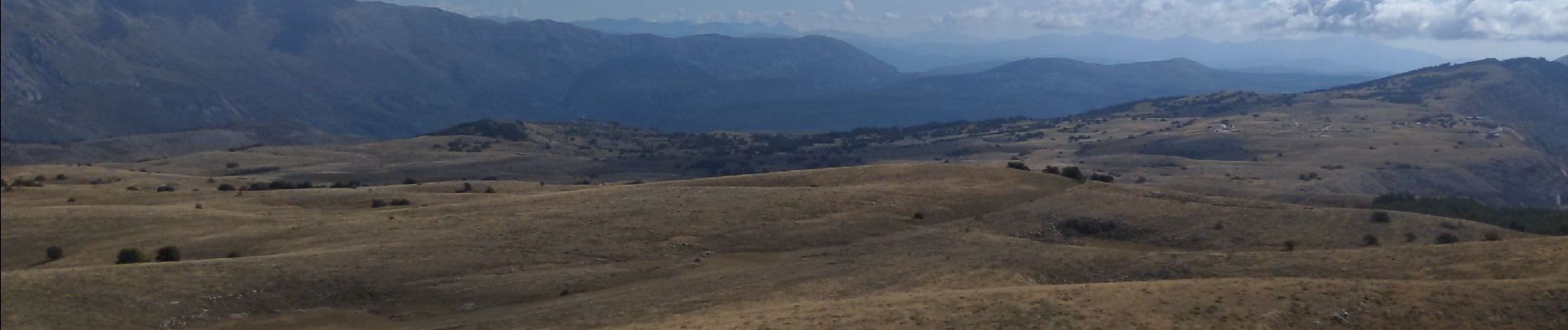
sommet de calern

pln30
User
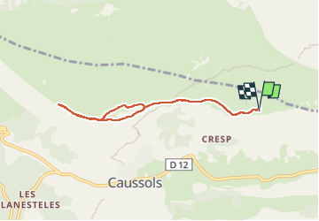

Length
7.2 km

Max alt
1447 m

Uphill gradient
225 m
Km-Effort
10.2 km

Min alt
1244 m

Downhill gradient
226 m
Boucle
Yes
Creation date :
2022-09-04 06:05:27.137
Updated on :
2022-09-14 07:15:02.662
2h17
Difficulty : Medium

FREE GPS app for hiking
 SityTrail
IGN / Geographical institutes
SityTrail Plus
The world is yours!
About
Trail Walking of 7.2 km to be discovered at Provence-Alpes-Côte d'Azur, Maritime Alps, Caussols. This trail is proposed by pln30.
Description
le sommet de calern au départ de l'observatoire
Photos


Positioning
Country:
France
Region :
Provence-Alpes-Côte d'Azur
Department/Province :
Maritime Alps
Municipality :
Caussols
Location:
Unknown
Start:(Dec)
Start:(UTM)
332886 ; 4846371 (32T) N.
Comments