


Beauvezer

Lionel Gaudin
User
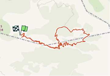

Length
12.4 km

Max alt
1940 m

Uphill gradient
862 m
Km-Effort
24 km

Min alt
1304 m

Downhill gradient
859 m
Boucle
Yes
Creation date :
2022-09-13 07:16:31.443
Updated on :
2022-09-13 13:59:23.249
3h50
Difficulty : Very difficult

FREE GPS app for hiking
 SityTrail
IGN / Geographical institutes
SityTrail Plus
The world is yours!
About
Trail Walking of 12.4 km to be discovered at Provence-Alpes-Côte d'Azur, Alpes-de-Haute-Provence, Beauvezer. This trail is proposed by Lionel Gaudin.
Positioning
Country:
France
Region :
Provence-Alpes-Côte d'Azur
Department/Province :
Alpes-de-Haute-Provence
Municipality :
Beauvezer
Location:
Unknown
Start:(Dec)
Start:(UTM)
309063 ; 4888561 (32T) N.
Comments