


Puy de sancy

raygautier
User
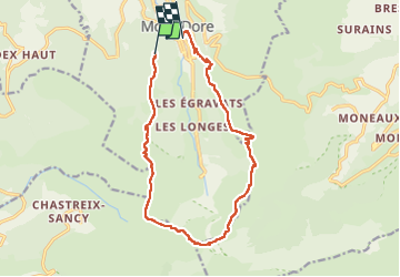

Length
15.3 km

Max alt
1862 m

Uphill gradient
815 m
Km-Effort
27 km

Min alt
1051 m

Downhill gradient
1014 m
Boucle
No
Creation date :
2022-09-13 07:50:05.0
Updated on :
2022-09-14 06:17:44.868
4h10
Difficulty : Very difficult

FREE GPS app for hiking
 SityTrail
IGN / Geographical institutes
SityTrail Plus
The world is yours!
About
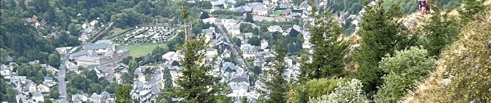
Trail Walking of 15.3 km to be discovered at Auvergne-Rhône-Alpes, Puy-de-Dôme, Mont-Dore. This trail is proposed by raygautier.
Photos

Positioning
Country:
France
Region :
Auvergne-Rhône-Alpes
Department/Province :
Puy-de-Dôme
Municipality :
Mont-Dore
Location:
Unknown
Start:(Dec)
Start:(UTM)
484581 ; 5046181 (31T) N.
Comments