


Sentier des douaniers Pénestin

karani27
User
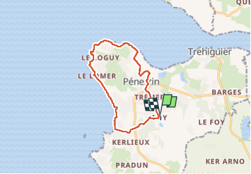

Length
11.9 km

Max alt
23 m

Uphill gradient
94 m
Km-Effort
13.1 km

Min alt
-1 m

Downhill gradient
95 m
Boucle
Yes
Creation date :
2022-09-17 11:42:39.449
Updated on :
2022-09-17 14:31:38.941
2h48
Difficulty : Easy

FREE GPS app for hiking
 SityTrail
IGN / Geographical institutes
SityTrail Plus
The world is yours!
About
Trail Walking of 11.9 km to be discovered at Brittany, Morbihan, Pénestin. This trail is proposed by karani27.
Description
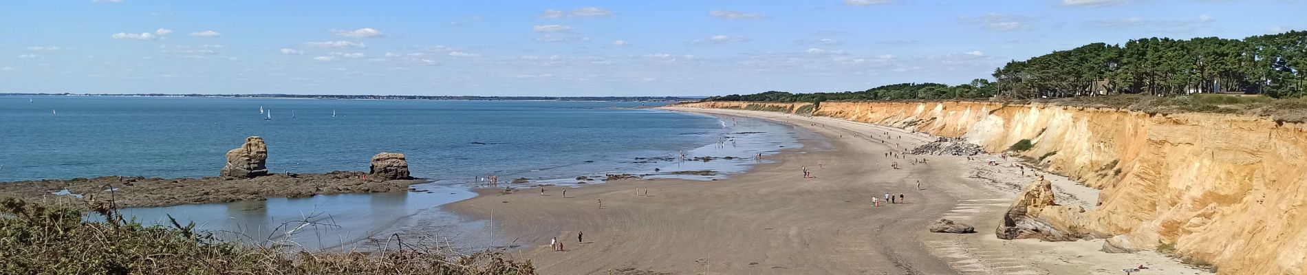
Sentier des douaniers à partir du domaine d'Inly
Photos


Positioning
Country:
France
Region :
Brittany
Department/Province :
Morbihan
Municipality :
Pénestin
Location:
Unknown
Start:(Dec)
Start:(UTM)
540189 ; 5257685 (30T) N.
Comments