


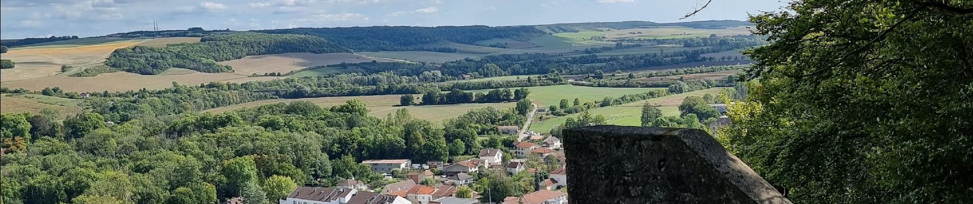
dans joinville depuis le Château du Haut

CDSM 55
User
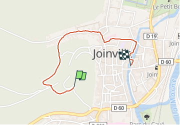

Length
1.3 km

Max alt
267 m

Uphill gradient
3 m
Km-Effort
1.6 km

Min alt
183 m

Downhill gradient
81 m
Boucle
No
Creation date :
2022-09-18 12:53:44.217
Updated on :
2022-09-18 13:17:26.25
22m
Difficulty : Easy

FREE GPS app for hiking
 SityTrail
IGN / Geographical institutes
SityTrail Plus
The world is yours!
About
Trail Walking of 1.3 km to be discovered at Grand Est, Haute-Marne, Joinville. This trail is proposed by CDSM 55.
Photos

Positioning
Country:
France
Region :
Grand Est
Department/Province :
Haute-Marne
Municipality :
Joinville
Location:
Unknown
Start:(Dec)
Start:(UTM)
657850 ; 5367562 (31U) N.
Comments
Petite balade sympa