


Oret Wagnée DEPS

thomarche
User
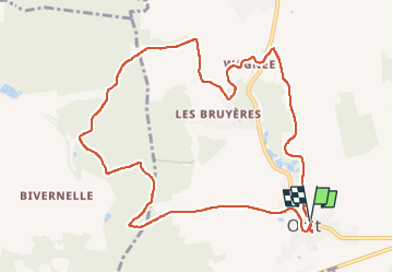

Length
10.7 km

Max alt
277 m

Uphill gradient
179 m
Km-Effort
13.1 km

Min alt
209 m

Downhill gradient
179 m
Boucle
Yes
Creation date :
2022-09-18 11:02:28.0
Updated on :
2022-09-18 13:26:08.873
2h23
Difficulty : Very easy

FREE GPS app for hiking
 SityTrail
IGN / Geographical institutes
SityTrail Plus
The world is yours!
About
Trail Walking of 10.7 km to be discovered at Wallonia, Namur, Mettet. This trail is proposed by thomarche.
Description
Très belle boucle à partir Centre village. Magnifiques chemins, différentes vues, bois, champs, pâtures. Très peu macadam très peu fréquenté. Et tout à fait ok par temps pluie (chemins très bien drainés)
Positioning
Country:
Belgium
Region :
Wallonia
Department/Province :
Namur
Municipality :
Mettet
Location:
Unknown
Start:(Dec)
Start:(UTM)
615148 ; 5573319 (31U) N.
Comments