


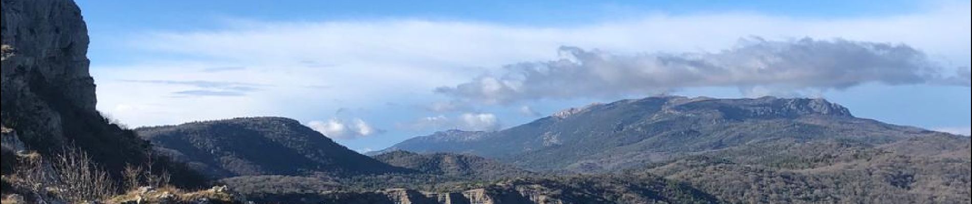
Plateau d'Agnis, au dessus de Mazaugues

FSantoni
User
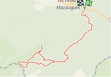

Length
13.5 km

Max alt
878 m

Uphill gradient
408 m
Km-Effort
19 km

Min alt
503 m

Downhill gradient
409 m
Boucle
Yes
Creation date :
2022-09-18 16:07:22.855
Updated on :
2023-02-10 18:16:13.182
4h18
Difficulty : Difficult

FREE GPS app for hiking
 SityTrail
IGN / Geographical institutes
SityTrail Plus
The world is yours!
About
Trail Walking of 13.5 km to be discovered at Provence-Alpes-Côte d'Azur, Var, Mazaugues. This trail is proposed by FSantoni.
Photos


Positioning
Country:
France
Region :
Provence-Alpes-Côte d'Azur
Department/Province :
Var
Municipality :
Mazaugues
Location:
Unknown
Start:(Dec)
Start:(UTM)
737562 ; 4803441 (31T) N.
Comments