


Les Puys de Belgentier

FSantoni
User
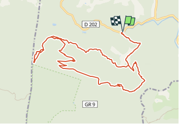

Length
14.4 km

Max alt
728 m

Uphill gradient
577 m
Km-Effort
22 km

Min alt
232 m

Downhill gradient
577 m
Boucle
Yes
Creation date :
2022-09-18 17:04:55.995
Updated on :
2022-09-18 17:38:10.1
5h01
Difficulty : Very difficult

FREE GPS app for hiking
 SityTrail
IGN / Geographical institutes
SityTrail Plus
The world is yours!
About
Trail Walking of 14.4 km to be discovered at Provence-Alpes-Côte d'Azur, Var, Méounes-lès-Montrieux. This trail is proposed by FSantoni.
Positioning
Country:
France
Region :
Provence-Alpes-Côte d'Azur
Department/Province :
Var
Municipality :
Méounes-lès-Montrieux
Location:
Unknown
Start:(Dec)
Start:(UTM)
740510 ; 4794340 (31T) N.
Comments