Trail Walking Saint-Pierre-de-Chartreuse - Bec de la scia reco  - Photo
© OpenStreetMap contributors
Length
Length
7.6 km
Max alt
Max alt
1761 m
Uphill gradient
Uphill gradient
469 m
Km-Effort
Km-Effort  
13.9 km
Min alt
Min alt
1329 m
Downhill gradient
Downhill gradient
465 m
Boucle
Boucle
Yes
Creation date :
2022-09-21 06:52:16.0
Updated on :
2022-10-03 16:02:48.291

(0 Reviews)

Walking
Walking
4h30
Difficulty : Medium

Scan this QR Code to open this trail in the SityTrail application

FREE GPS app for hiking

Logo SityTrail SityTrail

IGN / Geographical institutes

Download SityTrail from the App Store Download SityTrail from Google Play

Logo SityTrail SityTrail Plus

The world is yours!

Download SityTrail from the App Store Download SityTrail from Google Play Download SityTrail on Huawei AppGallery

About

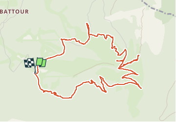
Trail Walking of 7.6 km to be discovered at Auvergne-Rhône-Alpes, Isère, Saint-Pierre-de-Chartreuse. This trail is proposed by michel.pegaz.

Description

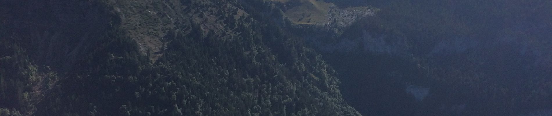
Départ Les Essarts Saint Pierre de Chartreuse. Prendre au parking le chemin qui part sud sud-est pour rejoindre le Gr tour des pays de Chartreuse. Pour ce faire il faudra dans les rochers du Mollard prendre une brèche (câblée) pour y accéder. Arrivé au Gr panneau prendre à l'est le sentier qui conduit à La Scia sommet du téléski. Juste au-dessus par un sentier rocheux on rejoint le Bec de la Scia et sa table d'orientation
on rejoint une table d'orintation

Elevation profile

Photos

Positioning

Country:
France
Region :
Auvergne-Rhône-Alpes
Department/Province :
Isère
Municipality :
Saint-Pierre-de-Chartreuse
Location:
Unknown
Start:(UTM)
721870 ; 5025069 (31T) N.


Close
My subscriptions