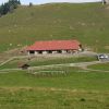
les vaux de cernay

mouchette94
User

Length
19.8 km

Max alt
182 m

Uphill gradient
369 m
Km-Effort
25 km

Min alt
95 m

Downhill gradient
365 m
Boucle
Yes
Creation date :
2022-09-23 09:00:04.111
Updated on :
2022-09-23 09:01:15.81
5h36
Difficulty : Very difficult

FREE GPS app for hiking
 SityTrail
IGN / Geographical institutes
SityTrail Plus
The world is yours!
About
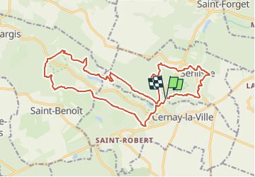
Trail Walking of 19.8 km to be discovered at Ile-de-France, Yvelines, Senlisse. This trail is proposed by mouchette94.
Positioning
Country:
France
Region :
Ile-de-France
Department/Province :
Yvelines
Municipality :
Senlisse
Location:
Unknown
Start:(Dec)
Start:(UTM)
423892 ; 5392261 (31U) N.
Comments