


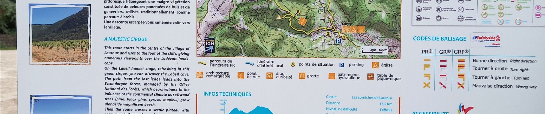
les corniches de Lauroux

nadinebondoux
User GUIDE
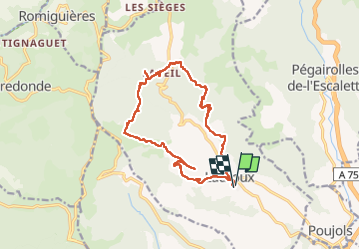

Length
16.3 km

Max alt
777 m

Uphill gradient
686 m
Km-Effort
25 km

Min alt
301 m

Downhill gradient
684 m
Boucle
Yes
Creation date :
2022-09-23 07:37:12.339
Updated on :
2022-09-23 21:06:21.979
5h31
Difficulty : Difficult

FREE GPS app for hiking
 SityTrail
IGN / Geographical institutes
SityTrail Plus
The world is yours!
About
Trail Walking of 16.3 km to be discovered at Occitania, Hérault, Lauroux. This trail is proposed by nadinebondoux.
Photos


25 photos in total. Please click on a photo to see them all in the gallery.
Positioning
Country:
France
Region :
Occitania
Department/Province :
Hérault
Municipality :
Lauroux
Location:
Unknown
Start:(Dec)
Start:(UTM)
523441 ; 4847013 (31T) N.
Comments