


prepa fagnes v2

JLDECK
User
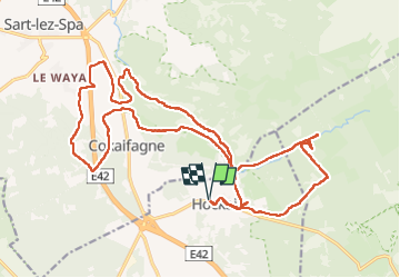

Length
23 km

Max alt
606 m

Uphill gradient
442 m
Km-Effort
29 km

Min alt
362 m

Downhill gradient
441 m
Boucle
Yes
Creation date :
2022-09-24 08:12:54.811
Updated on :
2022-09-24 14:04:12.763
5h13
Difficulty : Medium

FREE GPS app for hiking
 SityTrail
IGN / Geographical institutes
SityTrail Plus
The world is yours!
About
Trail Walking of 23 km to be discovered at Wallonia, Liège, Stavelot. This trail is proposed by JLDECK.
Positioning
Country:
Belgium
Region :
Wallonia
Department/Province :
Liège
Municipality :
Stavelot
Location:
Unknown
Start:(Dec)
Start:(UTM)
711754 ; 5596579 (31U) N.
Comments