


corrençon en vercors - darbounouse

maupassant38
User
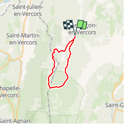

Length
17.3 km

Max alt
1439 m

Uphill gradient
474 m
Km-Effort
24 km

Min alt
1143 m

Downhill gradient
473 m
Boucle
Yes
Creation date :
2019-02-22 22:32:00.508
Updated on :
2019-02-22 22:32:00.531
3h47
Difficulty : Medium

FREE GPS app for hiking
 SityTrail
IGN / Geographical institutes
SityTrail Plus
The world is yours!
About
Trail Walking of 17.3 km to be discovered at Auvergne-Rhône-Alpes, Isère, Corrençon-en-Vercors. This trail is proposed by maupassant38.
Photos


Positioning
Country:
France
Region :
Auvergne-Rhône-Alpes
Department/Province :
Isère
Municipality :
Corrençon-en-Vercors
Location:
Unknown
Start:(Dec)
Start:(UTM)
698350 ; 4988747 (31T) N.
Comments