


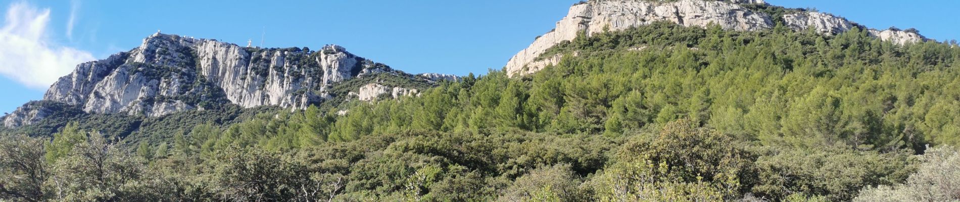
sommet du Coudon en partant de La Farlède

FSantoni
User
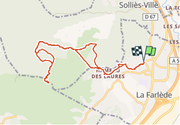

Length
12.4 km

Max alt
651 m

Uphill gradient
572 m
Km-Effort
20 km

Min alt
91 m

Downhill gradient
573 m
Boucle
Yes
Creation date :
2022-10-02 06:30:28.631
Updated on :
2022-10-02 15:41:52.821
6h02
Difficulty : Very difficult

FREE GPS app for hiking
 SityTrail
IGN / Geographical institutes
SityTrail Plus
The world is yours!
About
Trail Walking of 12.4 km to be discovered at Provence-Alpes-Côte d'Azur, Var, La Farlède. This trail is proposed by FSantoni.
Photos


Positioning
Country:
France
Region :
Provence-Alpes-Côte d'Azur
Department/Province :
Var
Municipality :
La Farlède
Location:
Unknown
Start:(Dec)
Start:(UTM)
259354 ; 4783708 (32T) N.
Comments