


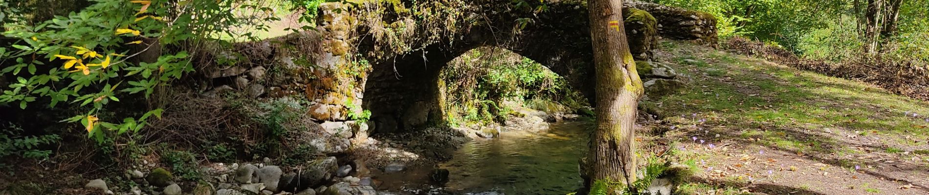
au pied du Calames

c.chehere
User
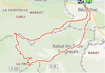

Length
14.1 km

Max alt
1136 m

Uphill gradient
638 m
Km-Effort
23 km

Min alt
578 m

Downhill gradient
640 m
Boucle
Yes
Creation date :
2022-10-03 06:09:55.982
Updated on :
2022-10-03 13:17:44.144
4h55
Difficulty : Easy

FREE GPS app for hiking
 SityTrail
IGN / Geographical institutes
SityTrail Plus
The world is yours!
About
Trail Walking of 14.1 km to be discovered at Occitania, Ariège, Bédeilhac-et-Aynat. This trail is proposed by c.chehere.
Photos


Positioning
Country:
France
Region :
Occitania
Department/Province :
Ariège
Municipality :
Bédeilhac-et-Aynat
Location:
Unknown
Start:(Dec)
Start:(UTM)
382607 ; 4747778 (31T) N.
Comments