


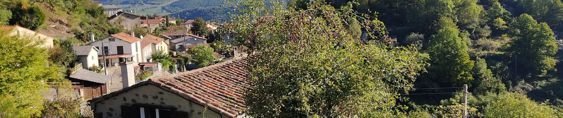
Le pont du diable

c.chehere
User
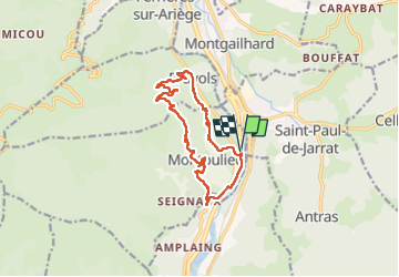

Length
14.5 km

Max alt
804 m

Uphill gradient
494 m
Km-Effort
21 km

Min alt
430 m

Downhill gradient
494 m
Boucle
Yes
Creation date :
2022-10-04 06:23:04.04
Updated on :
2023-05-25 16:49:35.519
4h26
Difficulty : Easy

FREE GPS app for hiking
 SityTrail
IGN / Geographical institutes
SityTrail Plus
The world is yours!
About
Trail Walking of 14.5 km to be discovered at Occitania, Ariège, Montoulieu. This trail is proposed by c.chehere.
Photos


Positioning
Country:
France
Region :
Occitania
Department/Province :
Ariège
Municipality :
Montoulieu
Location:
Unknown
Start:(Dec)
Start:(UTM)
388913 ; 4751645 (31T) N.
Comments