Trail Walking Gigondas - les antennes de montmirail - Photo
 labarone
labarone

User

© OpenStreetMap contributors
Length
Length
14.7 km
Max alt
Max alt
585 m
Uphill gradient
Uphill gradient
694 m
Km-Effort
Km-Effort  
24 km
Min alt
Min alt
234 m
Downhill gradient
Downhill gradient
696 m
Boucle
Boucle
Yes
Creation date :
2022-10-04 06:45:10.741
Updated on :
2022-10-04 14:39:05.141

(0 Reviews)

Walking
Walking
7h52
Difficulty : Difficult

Scan this QR Code to open this trail in the SityTrail application

FREE GPS app for hiking

Logo SityTrail SityTrail

IGN / Geographical institutes

Download SityTrail from the App Store Download SityTrail from Google Play

Logo SityTrail SityTrail World

The world is yours!

Download SityTrail from the App Store Download SityTrail from Google Play Download SityTrail on Huawei AppGallery

About

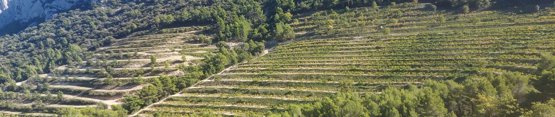
Trail Walking of 14.7 km to be discovered at Provence-Alpes-Côte d'Azur, Vaucluse, Gigondas. This trail is proposed by labarone.

Description

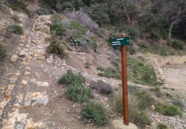
parcours assez dur dans les caillasses
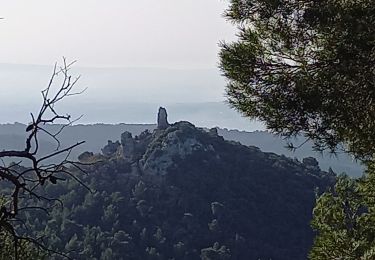
beau paysage
à faire plutôt dans ce sens car le départ est plus dur.
prendre les batons

Elevation profile

Photos

Positioning

Country:
France
Region :
Provence-Alpes-Côte d'Azur
Department/Province :
Vaucluse
Municipality :
Gigondas
Location:
Unknown
Start:(UTM)
660109 ; 4891951 (31T) N.

Trails nearby

Trail Walking Séguret - 170917 EnCours - Photo
Walking
MarcheEtReve

Walking

Very easy
(1)
Séguret, Provence-Alpes-Côte d'Azur, Vaucluse, France
6.3 km | 9.8 km-effort
2h 8min
Yes
Trail Walking Gigondas - Dentelles Montmirail   - Gigondas - Photo
Walking
tracegps

Walking

Very difficult
(3)
Gigondas, Provence-Alpes-Côte d'Azur, Vaucluse, France
12.4 km | 22 km-effort
7h 0min
Yes
Trail Walking Lafare - Le tour du Grand Montmirail - Lafare - Photo
Walking
tracegps

Walking

Medium
(3)
Lafare, Provence-Alpes-Côte d'Azur, Vaucluse, France
9.1 km | 13.9 km-effort
2h 30min
Yes
Trail Walking Lafare - Une approche des Dentelles de Montmirail - Photo
Walking
tracegps

Walking

Medium
(2)
Lafare, Provence-Alpes-Côte d'Azur, Vaucluse, France
6.6 km | 11.4 km-effort
3h 0min
Yes
Trail Walking Gigondas - Gigondas Dentelles Sarasines Grande Montagne  - Photo
Walking
GUIDE
nadinebondoux

Walking

Difficult
(1)
Gigondas, Provence-Alpes-Côte d'Azur, Vaucluse, France
15.4 km | 26 km-effort
5h 57min
Yes
Trail Walking Gigondas - Grand Montmirail par 3 Yeux - Photo
Walking
Drailloun

Walking

Medium
(2)
Gigondas, Provence-Alpes-Côte d'Azur, Vaucluse, France
13.3 km | 21 km-effort
4h 29min
Yes
Trail Walking Gigondas - dentelles de Montmirail  - Photo
Walking
fmarois

Walking

Very easy
(1)
Gigondas, Provence-Alpes-Côte d'Azur, Vaucluse, France
15.7 km | 26 km-effort
8h 9min
Yes
Trail Walking Gigondas - les dentelles de Montmirail depuis Gigondas - Photo
Walking
alpha-pyxidis

Walking

Medium
(4)
Gigondas, Provence-Alpes-Côte d'Azur, Vaucluse, France
6.6 km | 11.3 km-effort
2h 26min
Yes
Trail Walking Gigondas - 84 dentelles montmirail - Photo
Walking
himba26100

Walking

Difficult
Gigondas, Provence-Alpes-Côte d'Azur, Vaucluse, France
14.6 km | 25 km-effort
8h 18min
Yes


Close
My subscriptions