Trail Walking Belvédère - 
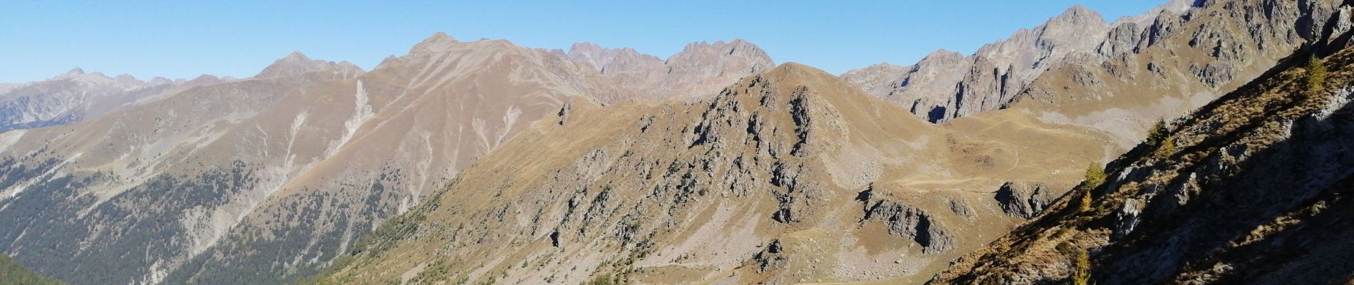
Cime de Paranova de St Grat - Photo
 domi06
domi06

User

© OpenStreetMap contributors
Length
Length
8.4 km
Max alt
Max alt
2536 m
Uphill gradient
Uphill gradient
974 m
Km-Effort
Km-Effort  
21 km
Min alt
Min alt
1559 m
Downhill gradient
Downhill gradient
975 m
Boucle
Boucle
Yes
Creation date :
2022-10-06 06:37:21.705
Updated on :
2022-10-08 16:43:09.544

(0 Reviews)

Walking
Walking
6h17
Difficulty : Medium

Scan this QR Code to open this trail in the SityTrail application

FREE GPS app for hiking

Logo SityTrail SityTrail

IGN / Geographical institutes

Download SityTrail from the App Store Download SityTrail from Google Play

Logo SityTrail SityTrail Plus

The world is yours!

Download SityTrail from the App Store Download SityTrail from Google Play Download SityTrail on Huawei AppGallery

About

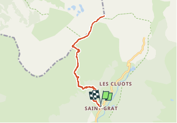
Trail Walking of 8.4 km to be discovered at Provence-Alpes-Côte d'Azur, Maritime Alps, Belvédère. This trail is proposed by domi06.

Description

Départ de la balise 275 au hameau de Saint Grat sur la route de la Gordolasque. Montée à la Baisse de Prals balise 375 , quitter le sentier balisé pour prendre une trace Nord-Est sur la ligne de crête pour atteindre la Cime de Paranova.
Le final nécessite l'usage des mains pour un franchissement de rocher .
Retour par le même itinéraire.
Cotation E5/T4/R4

Elevation profile

Photos

Positioning

Country:
France
Region :
Provence-Alpes-Côte d'Azur
Department/Province :
Maritime Alps
Municipality :
Belvédère
Location:
Unknown
Start:(UTM)
370597 ; 4879408 (32T) N.


Close
My subscriptions