


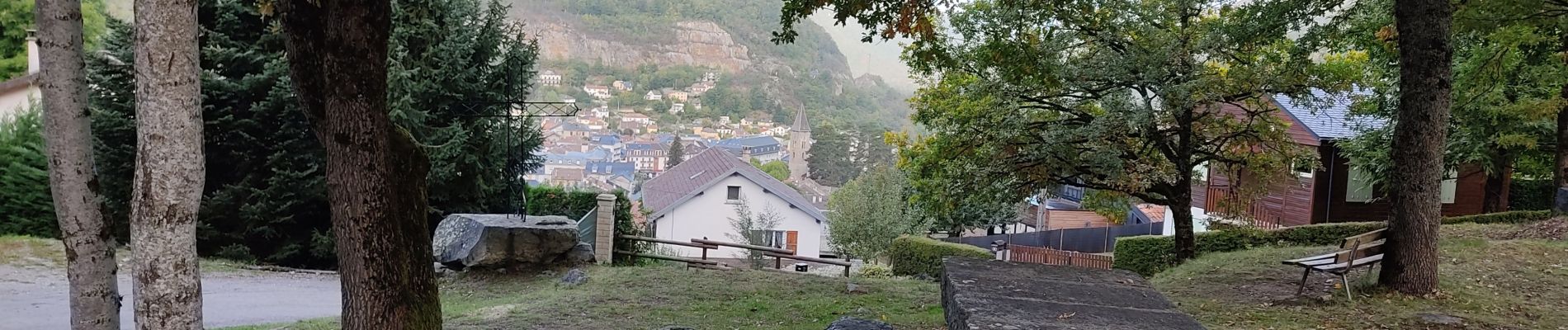
balade bleue au dessus d'Ax

c.chehere
User
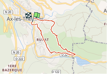

Length
3.8 km

Max alt
903 m

Uphill gradient
168 m
Km-Effort
6.1 km

Min alt
728 m

Downhill gradient
167 m
Boucle
Yes
Creation date :
2022-10-07 05:41:36.545
Updated on :
2022-10-07 07:22:57.428
1h22
Difficulty : Easy

FREE GPS app for hiking
 SityTrail
IGN / Geographical institutes
SityTrail Plus
The world is yours!
About
Trail Walking of 3.8 km to be discovered at Occitania, Ariège, Ax-les-Thermes. This trail is proposed by c.chehere.
Description
très belle rando sur d'excellents sentiers bien balisés. Idéal pour une mise en jambe.
Photos


Positioning
Country:
France
Region :
Occitania
Department/Province :
Ariège
Municipality :
Ax-les-Thermes
Location:
Unknown
Start:(Dec)
Start:(UTM)
405033 ; 4730236 (31T) N.
Comments