


tour complet du Jaunay

cath310
User
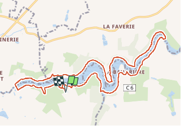

Length
13.2 km

Max alt
43 m

Uphill gradient
208 m
Km-Effort
15.9 km

Min alt
8 m

Downhill gradient
208 m
Boucle
Yes
Creation date :
2022-10-08 12:13:55.917
Updated on :
2022-10-08 15:50:58.377
3h35
Difficulty : Difficult

FREE GPS app for hiking
 SityTrail
IGN / Geographical institutes
SityTrail Plus
The world is yours!
About
Trail Walking of 13.2 km to be discovered at Pays de la Loire, Vendée, Landevieille. This trail is proposed by cath310.
Description
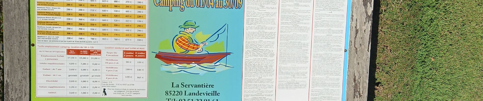
D/R camping du lac
Photos

Positioning
Country:
France
Region :
Pays de la Loire
Department/Province :
Vendée
Municipality :
Landevieille
Location:
Unknown
Start:(Dec)
Start:(UTM)
594210 ; 5167883 (30T) N.
Comments