


forêt de la flachere

gdela
User
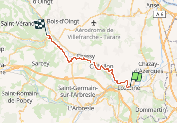

Length
17.8 km

Max alt
324 m

Uphill gradient
448 m
Km-Effort
23 km

Min alt
197 m

Downhill gradient
356 m
Boucle
No
Creation date :
2022-10-13 08:57:49.943
Updated on :
2022-10-18 14:10:06.877
4h12
Difficulty : Medium

FREE GPS app for hiking
 SityTrail
IGN / Geographical institutes
SityTrail Plus
The world is yours!
About
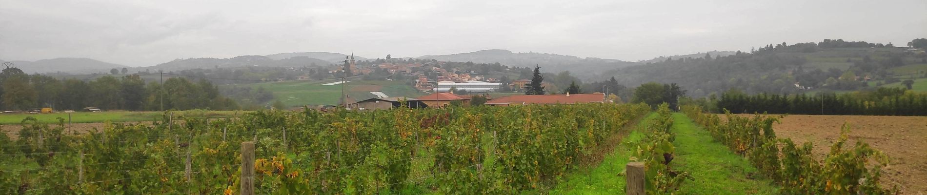
Trail Walking of 17.8 km to be discovered at Auvergne-Rhône-Alpes, Rhône, Lozanne. This trail is proposed by gdela.
Photos


Positioning
Country:
France
Region :
Auvergne-Rhône-Alpes
Department/Province :
Rhône
Municipality :
Lozanne
Location:
Unknown
Start:(Dec)
Start:(UTM)
630794 ; 5079437 (31T) N.
Comments