


Douelle

dewaeph
User

Length
12.6 km

Max alt
155 m

Uphill gradient
158 m
Km-Effort
14.7 km

Min alt
104 m

Downhill gradient
163 m
Boucle
Yes
Creation date :
2022-10-13 13:44:49.261
Updated on :
2022-10-13 15:10:36.004
1h25
Difficulty : Very easy

FREE GPS app for hiking
 SityTrail
IGN / Geographical institutes
SityTrail Plus
The world is yours!
About
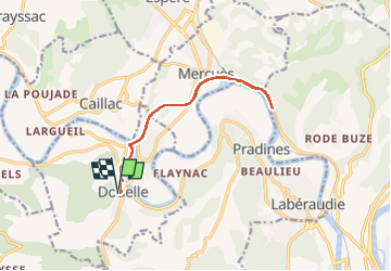
Trail Running of 12.6 km to be discovered at Occitania, Lot, Douelle. This trail is proposed by dewaeph.
Positioning
Country:
France
Region :
Occitania
Department/Province :
Lot
Municipality :
Douelle
Location:
Unknown
Start:(Dec)
Start:(UTM)
369462 ; 4925318 (31T) N.
Comments