


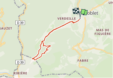

16.8 km | 23 km-effort


User


FREE GPS app for hiking
 SityTrail
IGN / Geographical institutes
SityTrail World
The world is yours!
Trail Walking of 7.6 km to be discovered at Occitania, Gard, Monoblet. This trail is proposed by Didier343434.
petite balade sympa à partir de monoblet jusqu'au sommet.
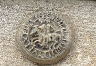
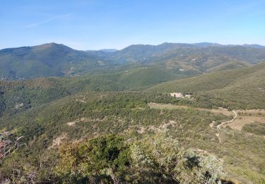
visuel 360 degrés

Walking

On foot


Walking

Road bike

Walking
Walking

Walking