BELVEDERES YENNE G1

papou73
User
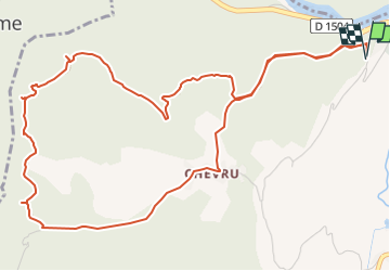

Length
7.2 km

Max alt
550 m

Uphill gradient
284 m
Km-Effort
11 km

Min alt
268 m

Downhill gradient
286 m
Boucle
Yes
Creation date :
2022-10-16 09:56:31.784
Updated on :
2022-10-16 09:57:23.952
3h21
Difficulty : Difficult

FREE GPS app for hiking
 SityTrail
IGN / Geographical institutes
SityTrail Plus
The world is yours!
About
Trail Walking of 7.2 km to be discovered at Auvergne-Rhône-Alpes, Savoy, Yenne. This trail is proposed by papou73.
Positioning
Country:
France
Region :
Auvergne-Rhône-Alpes
Department/Province :
Savoy
Municipality :
Yenne
Location:
Unknown
Start:(Dec)
Start:(UTM)
713983 ; 5064772 (31T) N.
Comments