


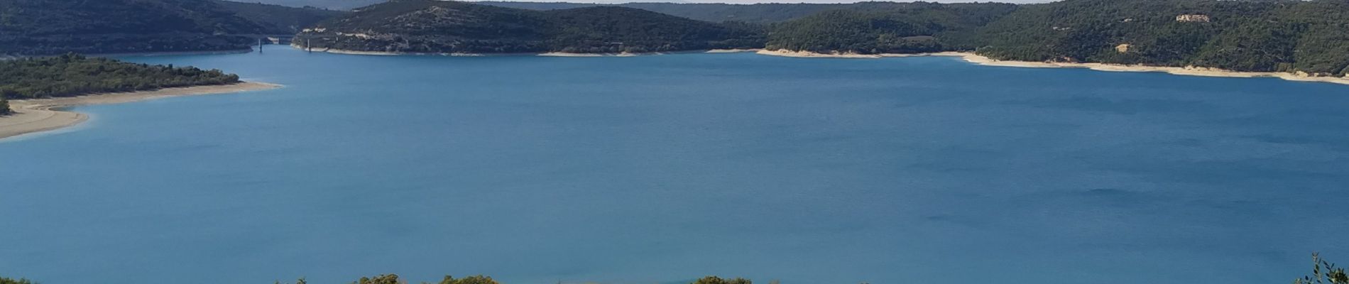
bauduen lac de Sainte croix

Michel DUBOIS
User
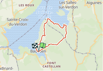

Length
12.6 km

Max alt
696 m

Uphill gradient
437 m
Km-Effort
18.5 km

Min alt
470 m

Downhill gradient
445 m
Boucle
Yes
Creation date :
2022-10-17 07:35:04.613
Updated on :
2022-10-17 12:59:41.562
3h33
Difficulty : Medium

FREE GPS app for hiking
 SityTrail
IGN / Geographical institutes
SityTrail Plus
The world is yours!
About
Trail Walking of 12.6 km to be discovered at Provence-Alpes-Côte d'Azur, Var, Bauduen. This trail is proposed by Michel DUBOIS.
Photos


Positioning
Country:
France
Region :
Provence-Alpes-Côte d'Azur
Department/Province :
Var
Municipality :
Bauduen
Location:
Unknown
Start:(Dec)
Start:(UTM)
272652 ; 4846055 (32T) N.
Comments