


Rochebaudin-Trou du Furet-Serre Gros 16km

thonyc
User GUIDE


Length
15.8 km

Max alt
966 m

Uphill gradient
767 m
Km-Effort
26 km

Min alt
326 m

Downhill gradient
771 m
Boucle
Yes
Creation date :
2022-10-17 07:19:40.52
Updated on :
2022-10-22 16:31:05.973
5h00
Difficulty : Difficult

FREE GPS app for hiking
 SityTrail
IGN / Geographical institutes
SityTrail Plus
The world is yours!
About
Trail Walking of 15.8 km to be discovered at Auvergne-Rhône-Alpes, Drôme, Rochebaudin. This trail is proposed by thonyc.
Description
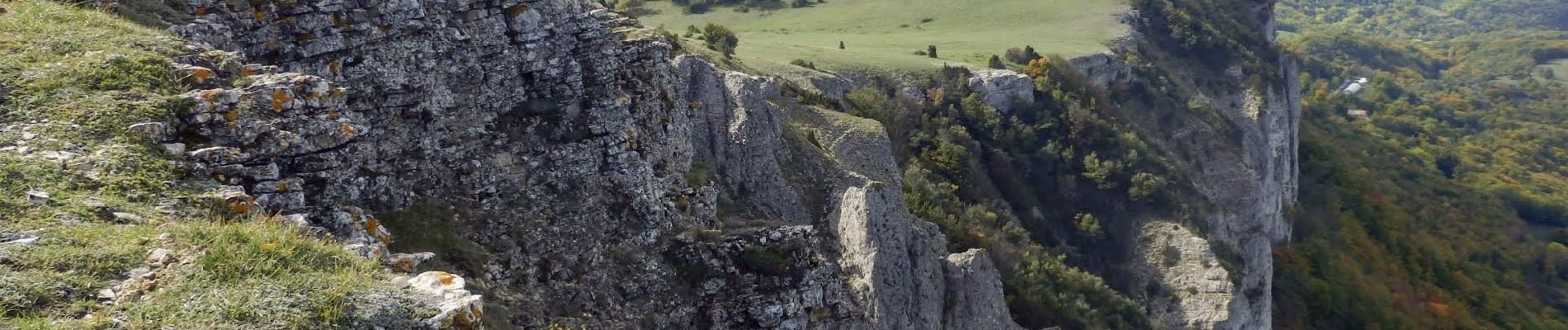
Très beau parcours:
joli village, les crêtes avec de magnifiques panoramas, la descente dans une très belle hêtraie.
Photos


Positioning
Country:
France
Region :
Auvergne-Rhône-Alpes
Department/Province :
Drôme
Municipality :
Rochebaudin
Location:
Unknown
Start:(Dec)
Start:(UTM)
661303 ; 4938310 (31T) N.
Comments