


Grès d'Annot Carte IGN 3541OT

domi06
User


7h23
Difficulty : Medium

FREE GPS app for hiking
 SityTrail
IGN / Geographical institutes
SityTrail Plus
The world is yours!
About
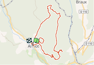
Trail Walking of 11.3 km to be discovered at Provence-Alpes-Côte d'Azur, Alpes-de-Haute-Provence, Annot. This trail is proposed by domi06.
Description
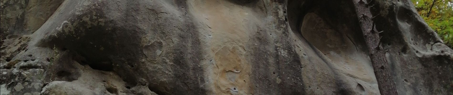
Au départ du village, le parcours monte dans une belle forêt de châtaigniers au milieu d'énormes blocs de grès. Il traverse ensuite l'étroit défilé des Garambes , le Jardin et la Chambre du Roi. Après un passage sur une corniche large mais vertigineuse on atteint un belvédère sur un large plateau gréseux donnant sur le vallon du Coulomp. Ensuite on franchit un joli plateau boisé jusqu'à l'arche rocheuse des Portettes avant de traverser une très belle forêt de châtaigniers centenaires pour arriver au sommet de ce parcours avant de redescendre sur Annot à travers des paysages forestiers typiques. Profitez pour visiter le village et sa belle église
Cotation E4/T3/R4
Photos


Positioning
Comments