


laneuville

libinsport
User
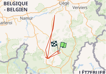

Length
202 km

Max alt
590 m

Uphill gradient
5446 m
Km-Effort
275 km

Min alt
173 m

Downhill gradient
5455 m
Boucle
No
Creation date :
2022-10-07 08:01:34.087
Updated on :
2022-10-21 08:41:29.914
61h24
Difficulty : Very difficult

FREE GPS app for hiking
 SityTrail
IGN / Geographical institutes
SityTrail Plus
The world is yours!
About
Trail Walking of 202 km to be discovered at Wallonia, Luxembourg, Sainte-Ode. This trail is proposed by libinsport.
Positioning
Country:
Belgium
Region :
Wallonia
Department/Province :
Luxembourg
Municipality :
Sainte-Ode
Location:
Unknown
Start:(Dec)
Start:(UTM)
677585 ; 5548979 (31U) N.
Comments