


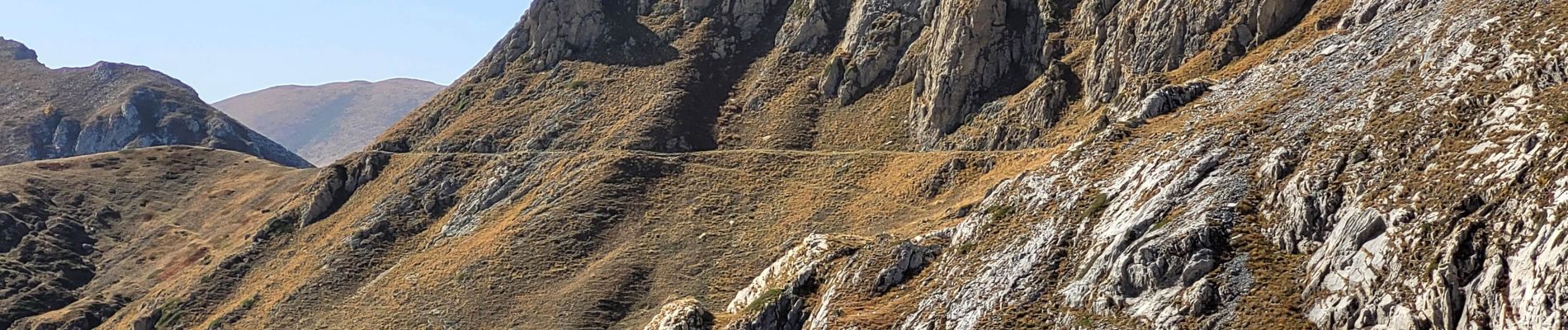
Haute route du sel du col de Tende au col des Seigneurs

franquen
User
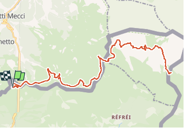

Length
35 km

Max alt
2237 m

Uphill gradient
1171 m
Km-Effort
51 km

Min alt
1874 m

Downhill gradient
1172 m
Boucle
Yes
Creation date :
2022-10-18 07:39:02.887
Updated on :
2022-11-03 17:05:34.671
4h30
Difficulty : Medium

FREE GPS app for hiking
 SityTrail
IGN / Geographical institutes
SityTrail Plus
The world is yours!
About
Trail Mountain bike of 35 km to be discovered at Provence-Alpes-Côte d'Azur, Maritime Alps, Tende. This trail is proposed by franquen.
Photos


Positioning
Country:
France
Region :
Provence-Alpes-Côte d'Azur
Department/Province :
Maritime Alps
Municipality :
Tende
Location:
Unknown
Start:(Dec)
Start:(UTM)
385374 ; 4889650 (32T) N.
Comments