


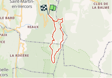
Circuit plateau du Vercors

olivier26
User

Length
12.7 km

Max alt
1449 m

Uphill gradient
272 m
Km-Effort
16.3 km

Min alt
1298 m

Downhill gradient
276 m
Boucle
Yes
Creation date :
2014-12-10 00:00:00.0
Updated on :
2014-12-10 00:00:00.0
3h18
Difficulty : Easy

FREE GPS app for hiking
 SityTrail
IGN / Geographical institutes
SityTrail Plus
The world is yours!
About
Trail Walking of 12.7 km to be discovered at Auvergne-Rhône-Alpes, Drôme, Saint-Martin-en-Vercors. This trail is proposed by olivier26.
Description
cette rando peut s'effectuer en famille sans aucun problème. Le circuit alterne sous bois et pelouse des hauts plateaux du Vercors.
Positioning
Country:
France
Region :
Auvergne-Rhône-Alpes
Department/Province :
Drôme
Municipality :
Saint-Martin-en-Vercors
Location:
Unknown
Start:(Dec)
Start:(UTM)
694826 ; 4987366 (31T) N.
Comments