


bussang_chapelle_des_ves

PhilippeC54
User
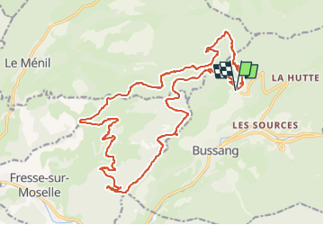

Length
25 km

Max alt
1055 m

Uphill gradient
831 m
Km-Effort
36 km

Min alt
620 m

Downhill gradient
830 m
Boucle
Yes
Creation date :
2022-10-25 08:00:16.646
Updated on :
2022-10-25 08:00:16.646
2h28
Difficulty : Difficult

FREE GPS app for hiking
 SityTrail
IGN / Geographical institutes
SityTrail Plus
The world is yours!
About
Trail Mountain bike of 25 km to be discovered at Grand Est, Vosges, Bussang. This trail is proposed by PhilippeC54.
Positioning
Country:
France
Region :
Grand Est
Department/Province :
Vosges
Municipality :
Bussang
Location:
Unknown
Start:(Dec)
Start:(UTM)
340310 ; 5307511 (32T) N.
Comments