Trail Walking Glorianes - GLORIANE DIMANCHE Fait - Photo
© OpenStreetMap contributors
Length
Length
12.7 km
Max alt
Max alt
1343 m
Uphill gradient
Uphill gradient
649 m
Km-Effort
Km-Effort  
21 km
Min alt
Min alt
792 m
Downhill gradient
Downhill gradient
653 m
Boucle
Boucle
Yes
Creation date :
2022-10-23 08:39:29.976
Updated on :
2023-05-07 09:41:27.797

(0 Reviews)

Walking
Walking
3h55
Difficulty : Medium

Scan this QR Code to open this trail in the SityTrail application

FREE GPS app for hiking

Logo SityTrail SityTrail

IGN / Geographical institutes

Download SityTrail from the App Store Download SityTrail from Google Play

Logo SityTrail SityTrail World

The world is yours!

Download SityTrail from the App Store Download SityTrail from Google Play Download SityTrail on Huawei AppGallery

About

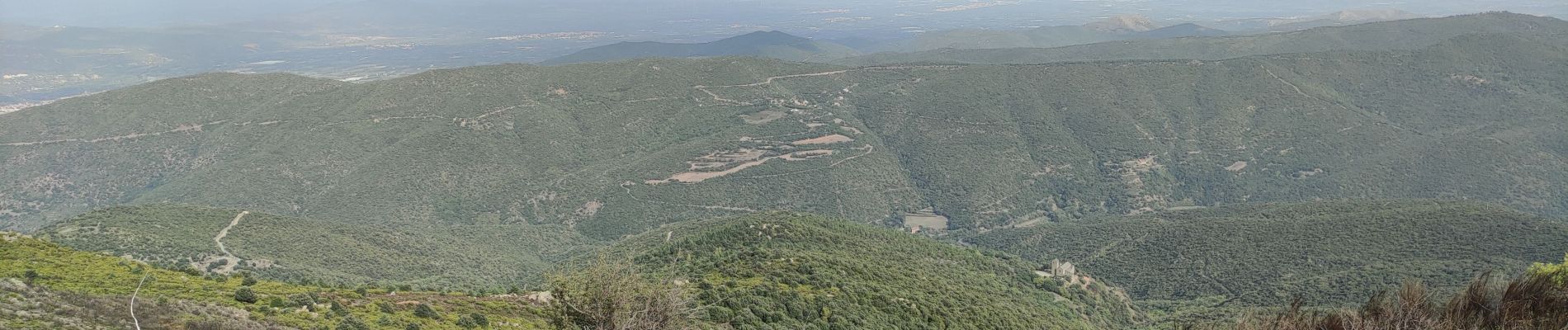
Trail Walking of 12.7 km to be discovered at Occitania, Pyrénées-Orientales, Glorianes. This trail is proposed by MarcOBRECHT.

Description

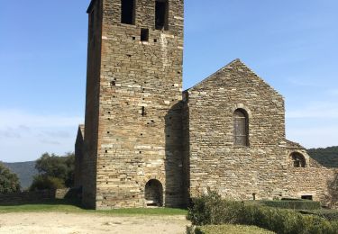
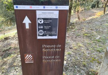
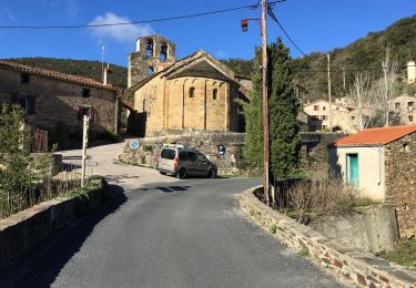
Depuis village vers col des Arques puis, à intersection, prendre sentier à droite vers chapelle Ste Anne. Retour le long de la clôture jusqu'à vue sur Serrabone.
Revenir en arrière jusqu'à intersection et se diriger vers Gloriannes

Elevation profile

Photos

Positioning

Country:
France
Region :
Occitania
Department/Province :
Pyrénées-Orientales
Municipality :
Glorianes
Location:
Unknown
Start:(UTM)
463461 ; 4715323 (31T) N.

Trails nearby

Trail Walking Boule-d'Amont - 20240104 Tour depuis le prieuré de Serrabonne  - Photo
Walking
ThonyM

Walking

Medium
Boule-d'Amont, Occitania, Pyrénées-Orientales, France
15.2 km | 26 km-effort
4h 37min
Yes
Trail Walking Baillestavy - 20221127 Baillestavy- Valmanya - - Prat Mitja - Photo
Walking
ThonyM

Walking

Difficult
Baillestavy, Occitania, Pyrénées-Orientales, France
16.8 km | 30 km-effort
5h 2min
Yes
Trail Walking Baillestavy - 20220519 Ballestavy - Photo
Walking
ThonyM

Walking

Medium
Baillestavy, Occitania, Pyrénées-Orientales, France
12.6 km | 21 km-effort
3h 28min
Yes
Trail Walking Boule-d'Amont - Serrabone /le roc rouge(le rocher du dragon):itinéraire 2 - Photo
Walking
robertperello

Walking

Medium
Boule-d'Amont, Occitania, Pyrénées-Orientales, France
10.1 km | 17.5 km-effort
3h 32min
Yes
Trail Walking Boule-d'Amont - Serra une - Photo
Walking
ombrabella

Walking

Medium
Boule-d'Amont, Occitania, Pyrénées-Orientales, France
10.4 km | 17.8 km-effort
3h 44min
Yes
Trail Walking Boule-d'Amont - 20210321 Boule d’Amont - Serrabone - Photo
Walking
ThonyM

Walking

Medium
Boule-d'Amont, Occitania, Pyrénées-Orientales, France
13.4 km | 23 km-effort
3h 58min
Yes
Trail Walking Boule-d'Amont - Serrabonne autour du prieuré  - Photo
Walking
MarieFrancoise

Walking

Medium
Boule-d'Amont, Occitania, Pyrénées-Orientales, France
9.3 km | 16.2 km-effort
4h 27min
Yes
Trail Walking Prunet-et-Belpuig - Boule d’amont Prunet-et-Belpuig la Trinité  - Photo
Walking
robertperello

Walking

Difficult
Prunet-et-Belpuig, Occitania, Pyrénées-Orientales, France
13.7 km | 19.4 km-effort
3h 25min
Yes
Trail Walking La Bastide - La Bastide-Palomere-StMarsal - Photo
Walking
ThonyM

Walking

Very difficult
La Bastide, Occitania, Pyrénées-Orientales, France
19.8 km | 31 km-effort
6h 51min
Yes


Close
My subscriptions