


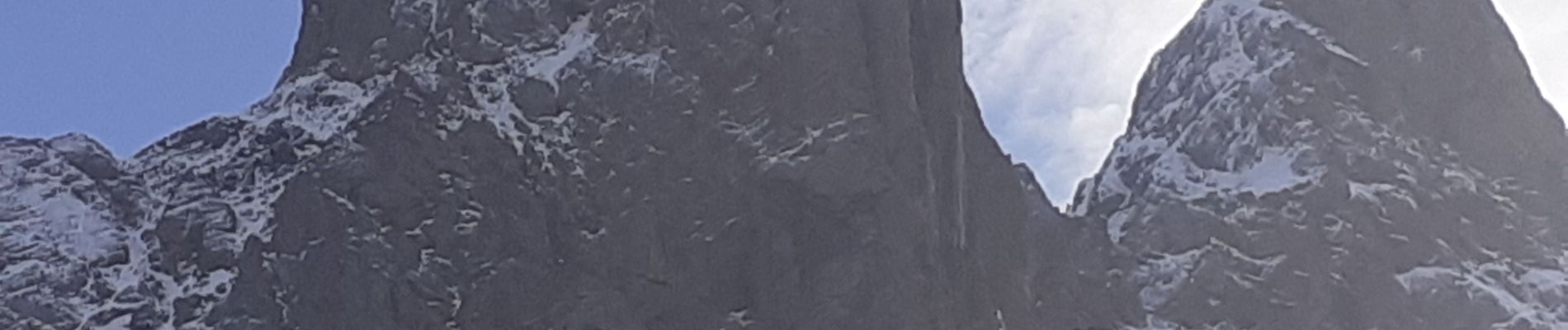
aiguilles d'arves La Motte

papou73
User
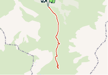

Length
6.8 km

Max alt
2240 m

Uphill gradient
319 m
Km-Effort
11.1 km

Min alt
1908 m

Downhill gradient
321 m
Boucle
Yes
Creation date :
2022-10-28 12:31:16.062
Updated on :
2022-10-28 14:58:34.101
1h46
Difficulty : Medium

FREE GPS app for hiking
 SityTrail
IGN / Geographical institutes
SityTrail Plus
The world is yours!
About
Trail Walking of 6.8 km to be discovered at Auvergne-Rhône-Alpes, Savoy, Albiez-Montrond. This trail is proposed by papou73.
Photos

Positioning
Country:
France
Region :
Auvergne-Rhône-Alpes
Department/Province :
Savoy
Municipality :
Albiez-Montrond
Location:
Unknown
Start:(Dec)
Start:(UTM)
290396 ; 5006052 (32T) N.
Comments