Gentinnes, via chapelle de l'Hermitage

flouzer
User
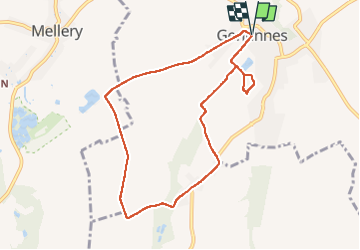

Length
7.9 km

Max alt
163 m

Uphill gradient
83 m
Km-Effort
9 km

Min alt
133 m

Downhill gradient
81 m
Boucle
Yes
Creation date :
2022-10-31 12:06:22.801
Updated on :
2022-10-31 14:04:00.141
1h53
Difficulty : Easy

FREE GPS app for hiking
 SityTrail
IGN / Geographical institutes
SityTrail Plus
The world is yours!
About
Trail Walking of 7.9 km to be discovered at Wallonia, Walloon Brabant, Chastre. This trail is proposed by flouzer.
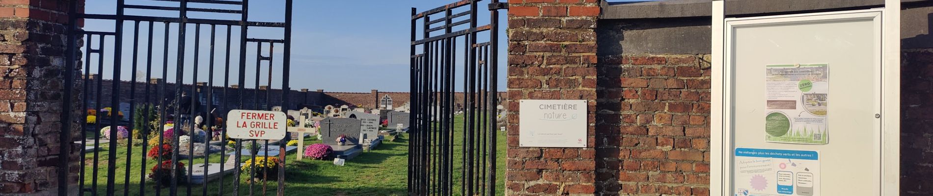
Photos


Positioning
Country:
Belgium
Region :
Wallonia
Department/Province :
Walloon Brabant
Municipality :
Chastre
Location:
Unknown
Start:(Dec)
Start:(UTM)
613472 ; 5604505 (31U) N.
Comments