


Clervaux Abbaye et Mecher 10 km boucle

rvapeldo
User GUIDE
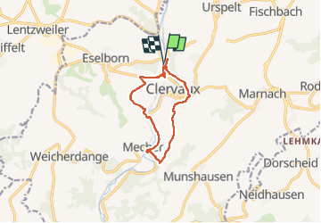

Length
10 km

Max alt
484 m

Uphill gradient
286 m
Km-Effort
13.8 km

Min alt
341 m

Downhill gradient
286 m
Boucle
Yes
Creation date :
2022-11-01 13:00:12.0
Updated on :
2022-11-03 20:39:30.42
3h29
Difficulty : Easy

FREE GPS app for hiking
 SityTrail
IGN / Geographical institutes
SityTrail Plus
The world is yours!
About
Trail Walking of 10 km to be discovered at Unknown, Canton Clervaux, Clervaux. This trail is proposed by rvapeldo.
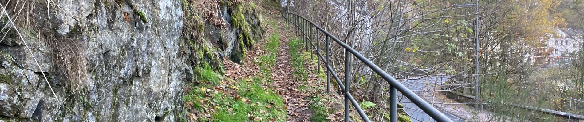
Photos


Positioning
Country:
Luxembourg
Region :
Unknown
Department/Province :
Canton Clervaux
Municipality :
Clervaux
Location:
Unknown
Start:(Dec)
Start:(UTM)
287045 ; 5549665 (32U) N.
Comments