


roqueroll issambres

Michel DUBOIS
User

Length
9 km

Max alt
237 m

Uphill gradient
288 m
Km-Effort
12.9 km

Min alt
16 m

Downhill gradient
289 m
Boucle
Yes
Creation date :
2022-10-24 07:01:14.133
Updated on :
2022-11-03 10:48:59.122
2h21
Difficulty : Easy

FREE GPS app for hiking
 SityTrail
IGN / Geographical institutes
SityTrail Plus
The world is yours!
About
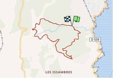
Trail Walking of 9 km to be discovered at Provence-Alpes-Côte d'Azur, Var, Roquebrune-sur-Argens. This trail is proposed by Michel DUBOIS.
Positioning
Country:
France
Region :
Provence-Alpes-Côte d'Azur
Department/Province :
Var
Municipality :
Roquebrune-sur-Argens
Location:
Unknown
Start:(Dec)
Start:(UTM)
313796 ; 4804319 (32T) N.
Comments