


bouverie collet redon

Michel DUBOIS
User
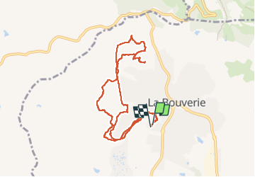

Length
10 km

Max alt
203 m

Uphill gradient
206 m
Km-Effort
12.7 km

Min alt
32 m

Downhill gradient
207 m
Boucle
Yes
Creation date :
2022-11-03 07:35:05.886
Updated on :
2022-11-03 10:49:01.209
2h32
Difficulty : Easy

FREE GPS app for hiking
 SityTrail
IGN / Geographical institutes
SityTrail Plus
The world is yours!
About
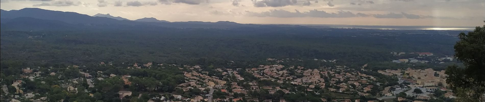
Trail Walking of 10 km to be discovered at Provence-Alpes-Côte d'Azur, Var, Roquebrune-sur-Argens. This trail is proposed by Michel DUBOIS.
Photos


Positioning
Country:
France
Region :
Provence-Alpes-Côte d'Azur
Department/Province :
Var
Municipality :
Roquebrune-sur-Argens
Location:
Unknown
Start:(Dec)
Start:(UTM)
309073 ; 4818714 (32T) N.
Comments