


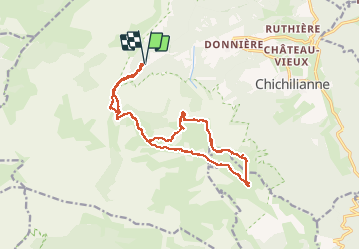
PAS DE L'ESSOR ET TÊTE CHEVALIÈRE

RD78-38
User

Length
26 km

Max alt
1946 m

Uphill gradient
1087 m
Km-Effort
40 km

Min alt
1192 m

Downhill gradient
1089 m
Boucle
Yes
Creation date :
2014-12-10 00:00:00.0
Updated on :
2020-07-11 00:25:08.616
11h14
Difficulty : Difficult

FREE GPS app for hiking
 SityTrail
IGN / Geographical institutes
SityTrail Plus
The world is yours!
About
Trail Walking of 26 km to be discovered at Auvergne-Rhône-Alpes, Isère, Chichilianne. This trail is proposed by RD78-38.
Positioning
Country:
France
Region :
Auvergne-Rhône-Alpes
Department/Province :
Isère
Municipality :
Chichilianne
Location:
Unknown
Start:(Dec)
Start:(UTM)
699503 ; 4965634 (31T) N.
Comments