


Tour des crêtes de Vatilieu - 06 Nov 2022

morganee
User
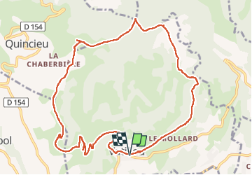

Length
12.1 km

Max alt
780 m

Uphill gradient
453 m
Km-Effort
18.2 km

Min alt
444 m

Downhill gradient
452 m
Boucle
Yes
Creation date :
2022-11-06 09:53:08.479
Updated on :
2022-11-06 14:57:11.592
5h03
Difficulty : Easy

FREE GPS app for hiking
 SityTrail
IGN / Geographical institutes
SityTrail Plus
The world is yours!
About
Trail Walking of 12.1 km to be discovered at Auvergne-Rhône-Alpes, Isère, Vatilieu. This trail is proposed by morganee.
Positioning
Country:
France
Region :
Auvergne-Rhône-Alpes
Department/Province :
Isère
Municipality :
Vatilieu
Location:
Unknown
Start:(Dec)
Start:(UTM)
689185 ; 5014196 (31T) N.
Comments