


sortie Offwiller

Rémy Isenmann
User
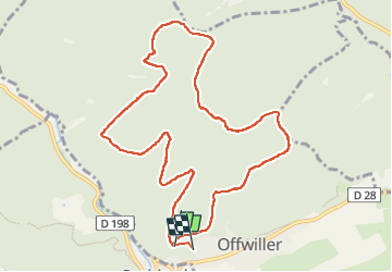

Length
10.5 km

Max alt
388 m

Uphill gradient
249 m
Km-Effort
13.9 km

Min alt
272 m

Downhill gradient
266 m
Boucle
No
Creation date :
2022-11-11 08:03:38.668
Updated on :
2022-11-11 11:05:48.935
2h46
Difficulty : Difficult

FREE GPS app for hiking
 SityTrail
IGN / Geographical institutes
SityTrail Plus
The world is yours!
About
Trail Walking of 10.5 km to be discovered at Grand Est, Bas-Rhin, Offwiller. This trail is proposed by Rémy Isenmann.
Positioning
Country:
France
Region :
Grand Est
Department/Province :
Bas-Rhin
Municipality :
Offwiller
Location:
Unknown
Start:(Dec)
Start:(UTM)
392407 ; 5418530 (32U) N.
Comments