


bastide de vescagne du col de vence

franquen
User
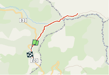

Length
7.3 km

Max alt
953 m

Uphill gradient
379 m
Km-Effort
12.2 km

Min alt
642 m

Downhill gradient
356 m
Boucle
No
Creation date :
2022-11-11 09:06:34.835
Updated on :
2022-11-11 11:15:22.114
2h05
Difficulty : Medium

FREE GPS app for hiking
 SityTrail
IGN / Geographical institutes
SityTrail Plus
The world is yours!
About
Trail Walking of 7.3 km to be discovered at Provence-Alpes-Côte d'Azur, Maritime Alps, Coursegoules. This trail is proposed by franquen.
Positioning
Country:
France
Region :
Provence-Alpes-Côte d'Azur
Department/Province :
Maritime Alps
Municipality :
Coursegoules
Location:
Unknown
Start:(Dec)
Start:(UTM)
344640 ; 4847959 (32T) N.
Comments