


Le hameau de Sornin

crocau
User
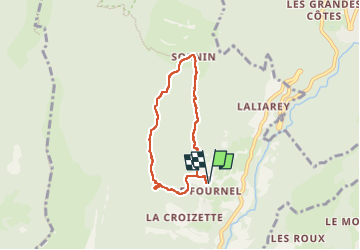

Length
5.8 km

Max alt
1387 m

Uphill gradient
463 m
Km-Effort
12 km

Min alt
925 m

Downhill gradient
469 m
Boucle
Yes
Creation date :
2022-11-11 12:32:42.988
Updated on :
2022-11-11 15:19:59.056
2h46
Difficulty : Medium

FREE GPS app for hiking
 SityTrail
IGN / Geographical institutes
SityTrail Plus
The world is yours!
About
Trail Walking of 5.8 km to be discovered at Auvergne-Rhône-Alpes, Isère, Engins. This trail is proposed by crocau.
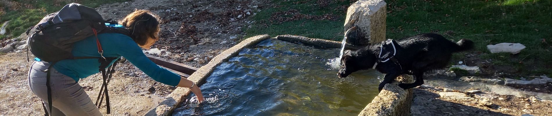
Photos


Positioning
Country:
France
Region :
Auvergne-Rhône-Alpes
Department/Province :
Isère
Municipality :
Engins
Location:
Unknown
Start:(Dec)
Start:(UTM)
705773 ; 5007680 (31T) N.
Comments